This site requires that JavaScripts be enabled in your browser. For instructions,
click here
+ Contact NASA
Directory Listing -- COVE
NASA LaRC Building 1196A CAPABLE Site : BSRN-PLUS Data Files
BSRN Site Managers:
Fred Denn
,
Bryan Fabbri
+ For additional info on this BSRN site click here
‹‹‹‹ Back One
- history -
Forward One ››››
+ Return to The NASA LaRC CRAVE/COVE Program Main Page
To download a file
right click
on its link and select save.
Files in this folder:
Size (bytes):
Modified:
+ 2016001-2016320_L1archiveALL-B06.DAT
139644881
2021-04-07 21:01pm
+ 2015001-2015365_L1archiveALL-B06.DAT
159181756
2021-04-07 20:53pm
+ 2014001-2014365_L1archiveALL-B06.DAT
157941115
2021-04-07 20:45pm
+ 2013001-2013365_L1archiveALL-B06.DAT
155406849
2021-04-07 20:36pm
+ 2012001-2012366_L1archiveALL-B06.DAT
155424031
2021-04-07 20:27pm
+ 2011001-2011365_L1archiveALL-B06.DAT
154865907
2021-04-07 20:17pm
+ 2010001-2010365_L1archiveALL-B06.DAT
155244580
2021-04-07 20:05pm
+ 2009001-2009365_L1archiveALL-B06.DAT
154591871
2021-04-07 19:55pm
+ 2008001-2008366_L1archiveALL-B06.DAT
155860288
2021-04-07 19:46pm
+ 2007001-2007365_L1archiveALL-B06.DAT
156066498
2021-04-07 19:36pm
+ 2006001-2006365_L1archiveALL-B06.DAT
155229556
2021-03-31 20:32pm
+ 2005001-2005365_L1archiveALL-B06.DAT
156408906
2021-03-31 20:22pm
+ 2004001-2004366_L1archiveALL-B06.DAT
158600430
2021-03-31 20:13pm
+ 2003001-2003365_L1archiveALL-B06.DAT
158285858
2021-03-31 20:03pm
+ 2002001-2002365_L1archiveALL-B06.DAT
158730283
2021-03-31 19:54pm
+ 2001001-2001365_L1archiveALL-B06.DAT
159065746
2021-03-31 19:46pm
+ 2000122-2000366_L1archiveALL-B06.DAT
108788714
2021-03-31 19:31pm
Page Curator: Jay Madigan
NASA Official: Greg Schuster
Page Last Modified:
12/05/2017
+ NASA Communications Policy
+ Freedom of Information Act
+ Budgets, Strategic Plans and Accountability Reports
+ Inspector General Hotline
+ Equal Employment Opportunity Data Posted Pursuant to the No Fear Act
+ USA.gov
+ Open Government at NASA
+ Privacy Policy and Important Notices
+ Multimedia Browser Plug-ins
+ Comments or Questions?
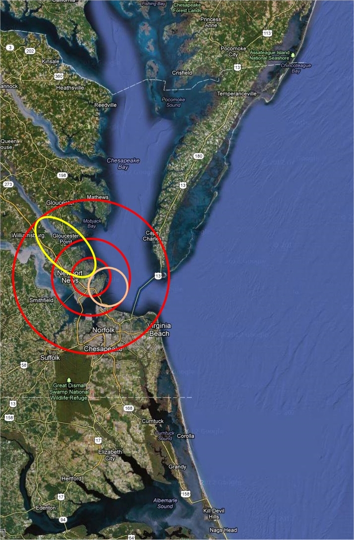
BSRN-LRC-49
Large area view.
Latitude: 37.1038
Longitude: -76.3872
Elevation: 3 m Above sea level
Scenes: urban, marsh, bay, river and farm.
Legend
The
inner red
circle is a 20km CERES foot print centered on the BSRN-LRC site.
The
pink
circle represents a possible tangential 20km foot print.
The
middle red
circle represents the area in which a 20km foot print could fall and still see the site.
Yellow
is a sample 40 deg off nadir foot print.
The
outer red
circle is the region which would be seen by a possible 40 deg off nadir foot print.
The BSRN-LRC sun tracker at the NASA Langley Research Center on a snowy day (02/20/2015)
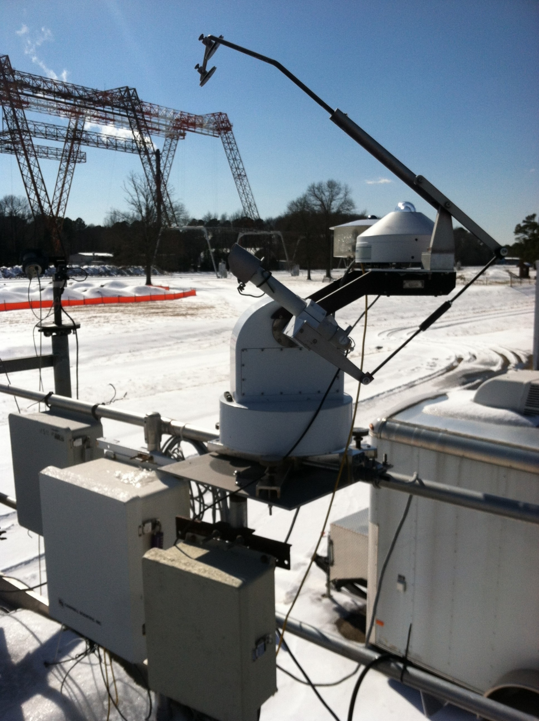 The BSRN-LRC sun tracker at the NASA Langley Research Center on a snowy day (02/20/2015)